Amid the flat plains of Donetsk Oblast, they suddenly appear — towering white cliffs, as if a fragment of another world had been cast here by mistake. The Bilokuzminivski Cliffs are nothing like the typical tourist spots with railings and cafes. This is a place where time is measured in eras, and space — by the wind.
| What? | Description |
|---|---|
| Name | The Bilokuzminivski Chalk Cliffs |
| Location | Bilokuzminivka, Donetsk Oblast |
| Object type | natural geological landmark |
| Height of the cliffs | ~82 feet (25 meters) (Mount Mech) |
| Status | a geological natural monument of local significance; since 2004 — Section No. 4 of the Kramatorsk Regional Landscape Park |
The Ocean Beneath Your Feet
What looks like a science fiction set today is actually a geological archive spanning millions of years. These rocks are the remnants of the ancient Tethys Ocean, which covered eastern Ukraine about 90 million years ago, during the Cretaceous period of the Mesozoic era.
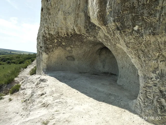
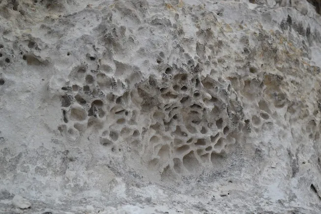
The rock consists of 98% pure chalk — the compressed shells of microscopic marine organisms. If you look closely at the vertical sections, you can see dark layers. This is flint: the very rock from which Paleolithic humans made their first tools. The rock preserves two layers of human presence at once — prehistoric and quite visible, if you know where to look.
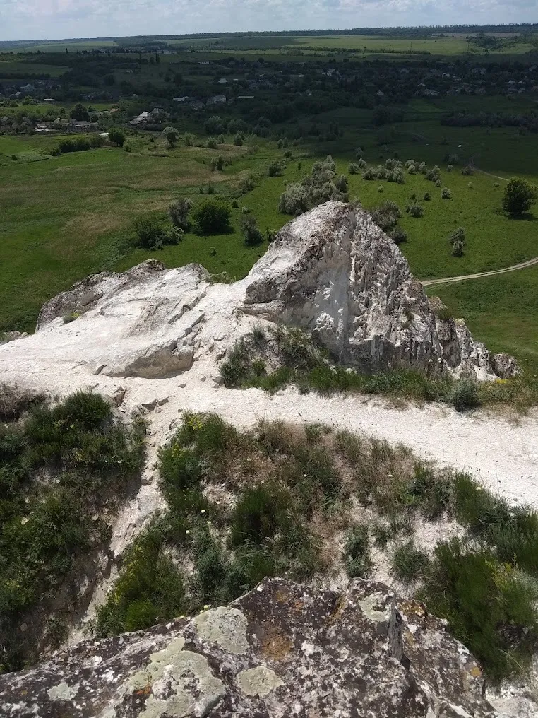
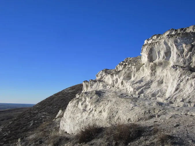
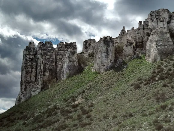
Over millions of years, wind and rain have carved sharp “fingers”, deep niches, and small caves out of the fragile rock. The highest point — Mount Mech — reaches 25 meters. The name speaks for itself: the silhouette of the rock truly resembles a blade when viewed from the side.
Sense of place
Locals have long referred to the cliffs as the “white walls”. Their own acoustic laws apply here: the sound of footsteps echoes off the dense rock with a strange delay, and the wind hums low in the crevices, almost like an organ.
In addition to their geological history, the cliffs also hold human memories. At the beginning of the 20th century, a hermit named Stepan Bosy lived here. He carved a small cell out of the soft chalk with his own hands — traces of it can still be found today if you look closely at the base of the cliffs.
Light is the main director of this place. At dawn, the chalk is cold and steely. In the evening, an hour before sunset, it absorbs the warm light and turns almost golden. This is one of those rare cases where the location looks better in person than in a photo.
What to See and Do
The cliffs are a compact area with no marked trails or tourist infrastructure. That is part of their appeal.
It’s worth exploring not only the cliffs themselves but also the surrounding ravines. There, you’ll find calciphiles — plants that have adapted to pure limestone and are rarely found in other environments. For photographers, the most interesting vantage point is the view from below, at the base, where the white cliffs fill the entire frame against the sky.
If you plan to combine this with other locations in the region, take a look at the “Natural Anomalies of Ukraine” route — Donetsk Oblast, with its steppe chalk massifs, holds a special place there.
Little-known facts
- The chalk rock of the cliffs was formed not from stone, but from organic matter: every centimeter consists of millions of microscopic foraminifera shells.
- Mount Mech (sword in Ukrainian) got its name from its distinctive profile, visible from the south. From other angles, it looks like a rounded hill — and only the right perspective reveals the “blade”.
- Stepan Bosiy, a hermit from the early 20th century, was not the only one to use chalk as a building material. In neighboring areas of Donetsk Oblast, entire farm buildings constructed from chalk blocks have been preserved.
- After rain, the cliffs become twice as dangerous: wet chalk is as slippery as soap, and the swollen rock increases the risk of collapse.
- The calcareous flora in the ravines near the cliffs is protected along with the massif itself—this is another reason not to stray from the trails.
Practical Information
⚠️ Safety and Current Status
As of 2026, this location is in a frontline region. Before your trip, be sure to check mine safety maps and obtain up-to-date information from the local military-civilian administration. Do not skip this step, even if the trail is described as “safe” in older publications.
Chalk rock is fragile and prone to sudden collapses — do not approach the edge of the cliff. There are no guardrails on the cliffs.
Do not leave markings on the surface: chalk is vulnerable, and “autographs” accelerate erosion and spoil the site’s appearance for all future visitors.
When to Go
The best time is an hour before sunset, the “golden hour”. That’s when the chalk takes on a warm hue, and the shadows cast by the outcrops make the terrain as striking as possible.
Avoid visiting right after a downpour: wet chalk turns into an extremely slippery surface, and the dirt roads leading to the village become impassable even to four-wheel drive vehicles.
How to get there
The location is 15 km from Kramatorsk, near the village of Bilokuzminivka.
- Coordinates: 48.6601, 37.6833
- Transportation: Any car will do in dry weather. It’s best to park on the side of the road at the entrance to the village to avoid damaging the steppe vegetation at the foot of the hill.
- Public transportation: There used to be a bus route between Kramatorsk and Bilokuzminivka, but it’s best to check the schedule locally, as it changes.
Conclusion
The Bilokuzminivski Cliffs aren’t just a spot for a quick selfie or a “must-see” destination. It’s a place to pause and reflect. For those who want to experience the passage of time — something no tour itinerary can capture.
Photographers should come here for the light and texture. Those interested in the geology and nature of the steppe East. And simply people who need silence without the tourist noise around them.
Just check the safety map first.