The Carpathians have plenty of beautiful places. But spots where you feel not just nature but the presence of people from thousands of years back are rare.
Pysanyi Kamin is exactly that kind of place. It’s a cluster of rocks in the mountains. But carved into them are more than thirty marks from different eras — and two autographs by giants of Ukrainian literature, both dated 1899.
General Information
| What? | Description |
|---|---|
| Name | Pysanyi Kamin (Mount Pysanyi Kamin) |
| Location | Verkhovyna district, Ivano-Frankivsk Oblast (between the villages of Bukovets, Verkhniy Yaseniv, and Biloberizka) |
| Coordinates | ~48.157°N, 25.039°E |
| Elevation | 4,006 ft (1,221 m) above sea level |
| Type | geological monument of nature, local significance |
| Protected area | ~12 acres (5 ha) |
| Rock type | sandstone |
| Length of the rock formation | ~260 ft (~80 m) |
The Geology of the Place
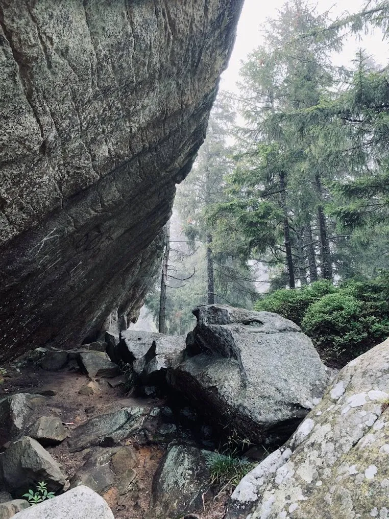
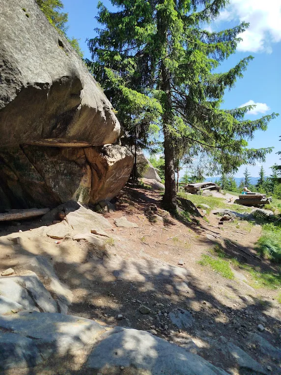
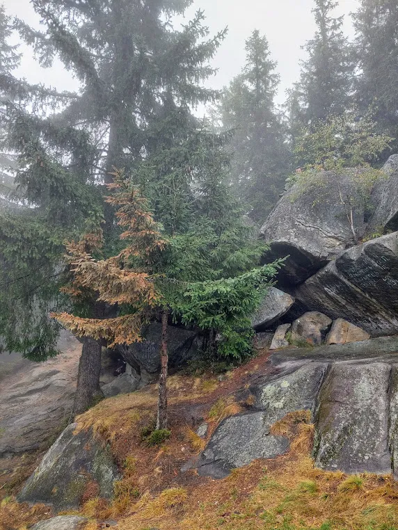
Pysanyi Kamin is a group of scenic sandstone rocks. The formation begins in the northwest with boulders 6.5–10 ft (2–3 m) tall and runs in a chain roughly 260 ft (80 m) to the southeast, gradually gaining height.
The mountain itself resembles a truncated pyramid: steep and sheer on the north side, overhanging the base in places. On the gentler side are the petroglyphs that gave the place its name.
The Petroglyphs: Thirty Marks and Nine Cups
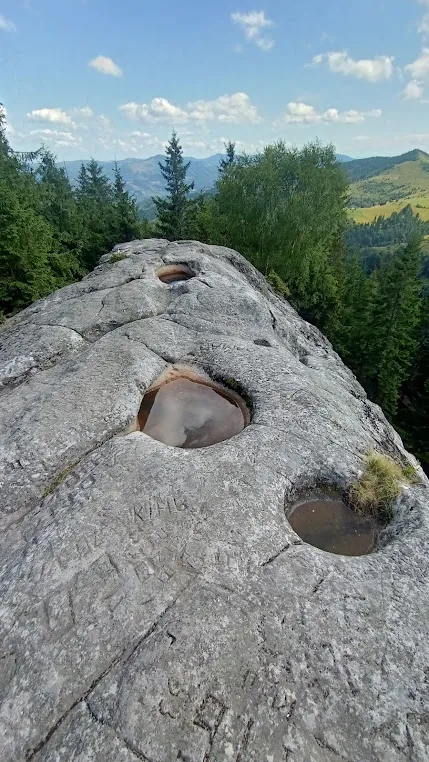
On the rock’s gentler face are more than thirty petroglyphs: crosses with unequal arms, circles, diamonds, and schematic human figures. Researchers say they belong to different eras, spanning the pagan period and early Christianity.
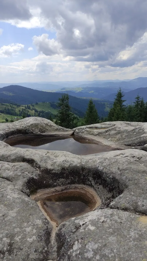
One detail stands apart: at the top are nine round cup-shaped hollows carved into the stone. Similar ones exist on the Sokilski Rocks in Kosiv district. Traces of chiseling with a sharp tool survive on the inner walls of some of the hollows, and the bottom of some shows signs of scorched stone. Bohdan Tomenchuk, an archaeologist and associate professor at Precarpathian University, believes these are signs of a pagan shrine.
Kobylianska and Stefanyk: 1899
Among the layered marks from different eras are two special autographs.
Clearly legible: “O. Kobylianska 1899.”
A little higher, nearly worn away: “V. Stefanyk 1899.”
Olha Kobylianska and Vasyl Stefanyk were here in the same summer — and left their signatures on the same rock where their ancestors had carved marks thousands of years earlier.
Dovbush and a UPA Hideout
Pysanyi Kamin is wrapped in legends about Oleksa Dovbush, the 18th-century Carpathian outlaw. According to local lore, this is where Dovbush met with a mountain sorcerer (molfar). There’s also a legend about a nearby grave of a Carpi king.
A surviving UPA hideout lies not far away; separate GPS tracks exist for those who want to walk the full route to it.
Routes: Four Ways to Get There
Several trails lead to Pysanyi Kamin:
From the Bukovets Pass (Bukovets village) — ~3.7 miles (~6 km) via Mount Kopilash. Open, treeless terrain; a long but exposed route.
From Verkhniy Yaseniv village — shorter, but with a steeper climb.
From Roztoky village — the longest route (~4.3 miles / ~7 km), along a mountain ridge.
From Biloberizka village — less well known, but rewarding: along the way are four to five sites in one go — Pysanyi Kamin itself, the Nadiya (Tsyvy) and Mlynskyi waterfalls, the “Kamiana Baba” (“Stone Woman”) rock, and the Dovbush Stone. At the Mlynskyi waterfall there’s a deep natural stone basin for swimming.
A popular full-length route: Kryvorivnia — Mount Ihrets (4,304 ft / 1,312 m) — Bukovets Pass — Mount Kopilash — Pysanyi Kamin — Verkhniy Yaseniv, 15 miles (24 km), with an elevation gain of 2,428 ft (740 m), taking about 9–10 hours.
A Local Landmark: Baba Paraska
In Biloberizka lives baba Paraska, a local legendary figure who welcomes hikers returning from Pysanyi Kamin and knows things about the place that even locals don’t. She’s one of Biloberizka’s unofficial “symbols.”
Coordinates: 48.1780819°N, 25.0161478°E.
What to See Nearby
Biloberizka and the surrounding area form a whole cluster of sites along one road:
- Nadiya Waterfall (Tsyvy) — coordinates: 48.169139, 25.019306
- Mlynskyi Waterfall — with a natural stone swimming basin
- “Kamiana Baba” rock — coordinates: 48.15772, 25.03980
- Dovbush Stone
- A cheese-making farm on the Kopilash alpine meadow — Hutsul cheeses, budz, vurda, at over 3,280 ft (1,000 m)
Fits well into the “Rocks and Ancient Sanctuaries of the Carpathians” route.
Practical Information
- Admission: free
- Facilities: none
- Signal: unstable — download your track offline beforehand
- Time needed: 1–2 hours (from Bukovets Pass) up to 9–10 hours (the full route via Ihrets)
- Footwear: hiking shoes essential; take extra care on the rocks in wet weather
How to Get There
- To Bukovets or Biloberizka: from Verkhovyna (~21 miles / ~33 km from Biloberizka), or from Kosiv/Ivano-Frankivsk
- By car: drive to the trailhead, then continue on foot
- Trails: vary in difficulty depending on the starting point; the easiest is from Bukovets Pass
Little-Known Details
- More than thirty petroglyphs cover the rock’s gentler face, and no scholarly theory has fully deciphered them yet.
- Nine cup-shaped hollows in the rock may be signs of a pagan sanctuary.
- Kobylianska and Stefanyk left their signatures here in 1899 — the same year Lesia Ukrainka’s “Lisovyi Narod” (“The Forest People”) was published.
- A UPA hideout survives nearby, with its own GPS track available.
- The route from Biloberizka leads straight to four or five natural sites at once — the most efficient option for those who want to see more in a single visit.
- Locals call the petroglyphs “revashi.”
Conclusion
Pysanyi Kamin isn’t just “a pretty rock for photos.” It’s a place where marks from different millennia sit on the same surface. A shrine, Kobylianska, Stefanyk, a wartime hideout — all on one rock.
And suddenly you realize: you’re just one more link in a long chain of people who came here — and moved on.