Some places look like a mistake in the landscape.
You’re driving an ordinary road through the Zhytomyr region: forests, fields, villages, nothing dramatic. And then, suddenly — a cliff edge, rock walls, water as clear as a mountain lake.
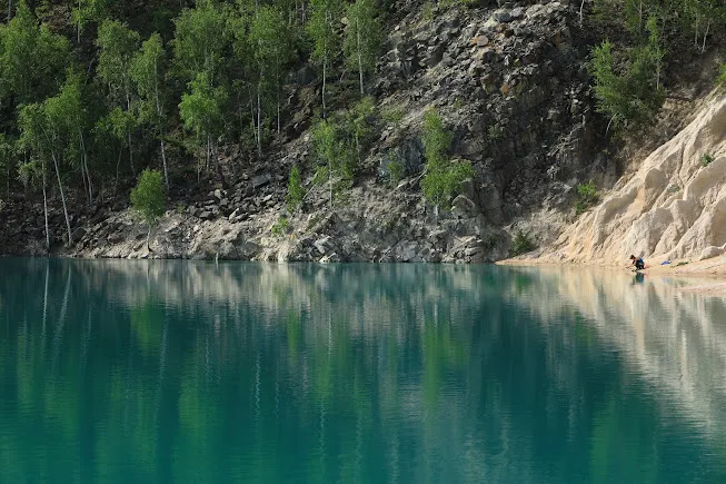
Druzhbivsky Quarry looks as if a piece of the Carpathians, or even the Balkans, had accidentally dropped into the middle of Polissia.
And the most interesting part is that this isn’t a natural wonder. It’s the result of human work.
General Information
| What? | Description |
|---|---|
| Official name | Druzhbivsky “Kvarts” Non-Metallic Minerals Quarry |
| Location | Druzhba urban-type settlement, Korosten district, Zhytomyr Oblast |
| Type of site | flooded granite quarry (quartzite-sandstone) |
| Year founded | 1948 |
| Area | ~306 acres (~124 ha) |
| Depth | up to 98 ft (30 m); individual points down to 164 ft (50 m) |
| Coordinates | 51.19583°N, 27.98451°E |
How the Quarry Came to Be
In 1948, a quarry was opened here for the needs of the Soviet military industry — crushed stone and building materials for bunkers, roads, and bridges. The enterprise’s official name was “Kvarts” (“Quartz”). The rock extracted here wasn’t ordinary granite but quartzite-sandstone: a dense, nearly white stone with feldspar inclusions. That’s what accounts for both the white cliffs and the exceptional clarity of the water.
A whole settlement grew up nearby for the workers and management — Druzhba, which gained urban-type settlement status in 1961.
The quarry was under the authority of Ukraine’s Ministry of Defense for a long time and remained largely inaccessible in that status. It was only transferred to the State Property Fund in 2020. Extraction officially stopped in 2015.
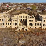
Once the equipment left, a pit up to 30 meters deep remained. It was gradually filled by underground springs, meltwater, and rain. Together with the ruined factory that still stands nearby, the quarry covers ~306 acres (124 ha).
Locals say old machinery remains at the bottom along with the water — divers occasionally come across traces of it.
Why the Water Is Turquoise
The effect comes from two factors together.
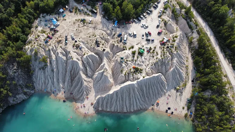
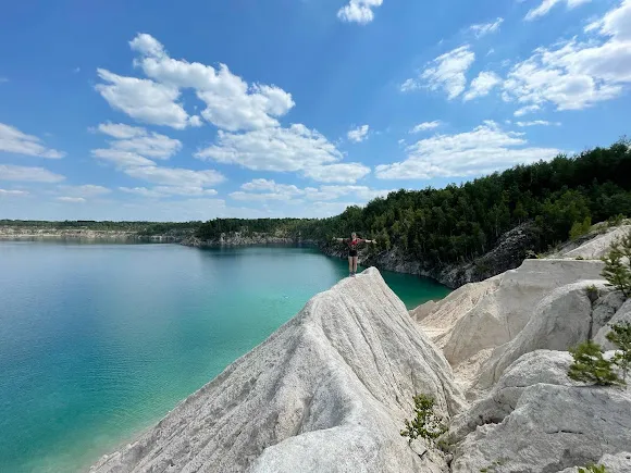
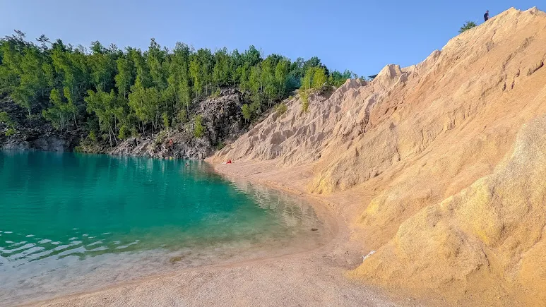
First, the quartzite-sandstone bottom — pale, almost snow-white. Second, the absence of silt and algae — the water is so clear that sunlight reaches all the way to the bottom. Some sources also mention blue clay covering part of the bottom. The result: the water shifts from deep blue to turquoise-green depending on the weather and the angle of the sun.
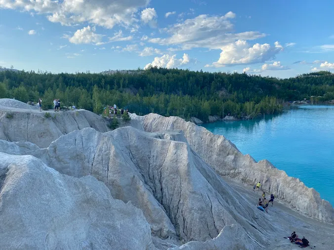
Locals have nicknamed the quarry the “Zhytomyr Pamukkale,” after the white deposits and the extraordinary color of the water.
Landscape and a Sense of Scale
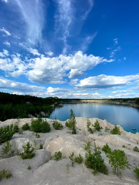
Druzhbivsky Quarry is a space of contrasts: vertical cliffs, ledges and terraces, pine forest along the edges, a sharp drop underfoot, and a silence that feels different from the forest’s.
Standing at the edge, it feels like looking into a mini-canyon — not the industrial pit it actually is.
No pomp. No tourist infrastructure. Just stone and water.
⚠️ Safety
The quarry looks like a lake, but it isn’t a beach:
- sudden depth changes (down to 98 ft / 30 m without warning);
- cold water even in summer, due to underground springs;
- slippery rock ledges;
- rockfalls along the edges;
- no rescue infrastructure whatsoever.
Swimming is only advisable if you’re a strong swimmer who understands the risks. For most visitors, this is a place to view and photograph, not for a beach outing.
What to Photograph
The best shots:
- an overhead view of the whole quarry bowl;
- cliffs and water at an angle;
- a person at the edge of a ledge for scale;
- close-up textures of the white quartzite-sandstone;
- sunset, when the water turns pink.
The light here is best between 5 and 7 p.m.
What’s Nearby and How to Fit It Into a Route
Korosten district is a whole cluster of geological sites. From Druzhbivsky Quarry, you can continue to:
- “Kamiane Selo” (“Stone Village”) (~9 miles / ~15 km) — a geological monument of nature, with granite over 2 billion years old;
- Dibrova Quarry — also flooded, popular among divers;
- Novoozerianskyi Quarry — smaller and quieter;
- Korosten (~19 miles / ~30 km), with the “Drevlianskyi” park on its cliffs.
All of this fits into the “Turquoise Quarries of Ukraine” route, with Druzhbivsky Quarry as one of its central stops.
How to Get There
The quarry is in Korosten district, ~146 miles (~235 km) from Kyiv, about 3 hours by car.
By car: the M07 highway (the Warsaw route, E373) via Zhytomyr and Korosten. Past Korosten, turn toward Bilokorovychi in the direction of Dibrova village, then continue to Druzhba. The final stretch is paved with gravel sections. A regular car can manage it in dry weather.
Coordinates: 51.19583°N, 27.98451°E.
Public transport: a suburban rail service runs from Korosten to Dibrova village — from there it’s about 3 miles (5 km) to the quarry. A bus also runs from Zhytomyr to Druzhba, though infrequently; check the current schedule.
Parking: on the roadside or a field track near the entrance to the site.
Practical Information
- Admission: free
- Facilities: none — bring water, food, and sun protection
- Signal: unstable — download maps offline
- Time needed: 30–90 minutes
- Best time: May–September, on a weekday (weekends bring crowds)
- Avoid going: right after rain (slippery clay on the descents), or at dusk (dangerous ledge edges)
Author’s Conclusion
Druzhbivsky Quarry isn’t a “pretty location.” It’s an honest one.
Here you can see how people cut into the earth — and how, over time, the earth turned that into something almost harmonious. A military pit became a turquoise lake. Industrial waste became a tourist stop.
Sometimes the most striking landscapes aren’t born from nature. They’re born from its patience.