In the Carpathians, it’s easy to get used to “big” things. Peaks. Waterfalls. Alpine meadows.
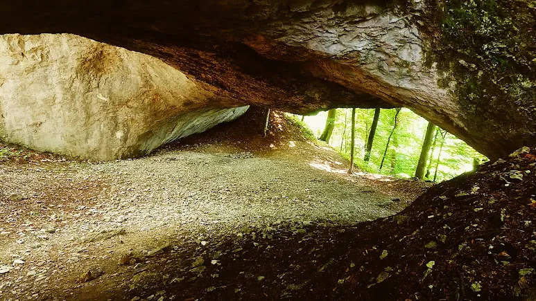
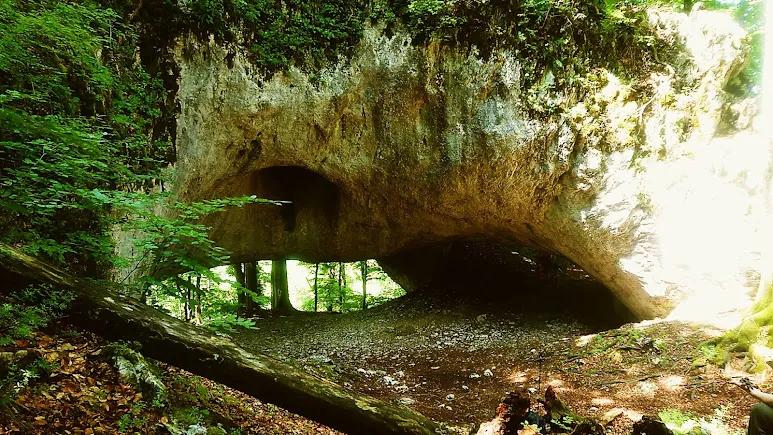
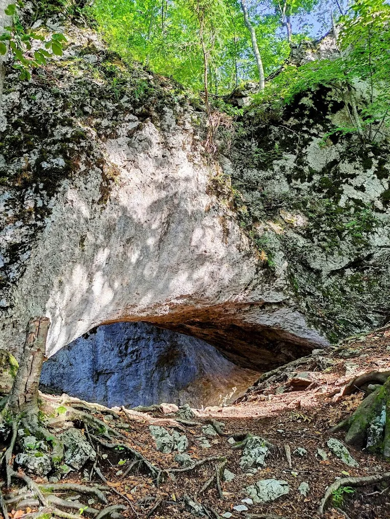
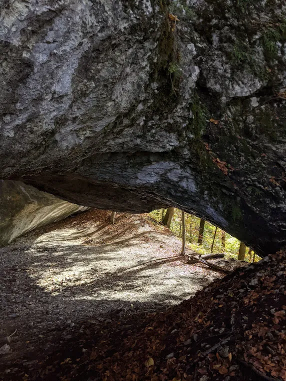
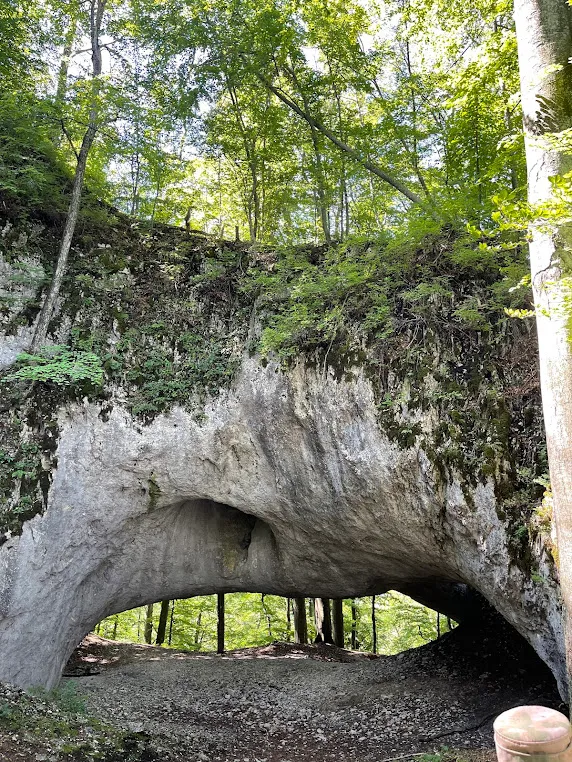
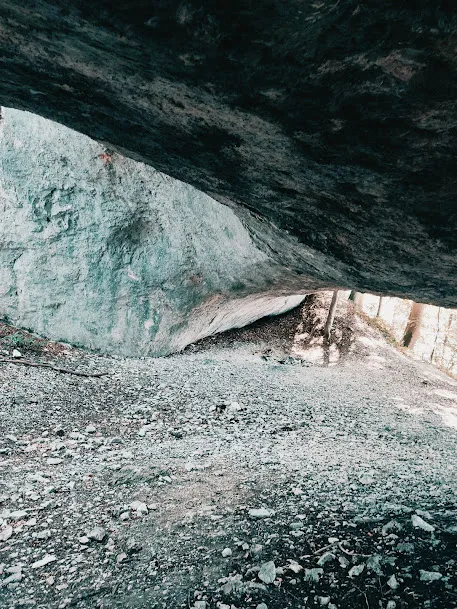
The Karst Bridge isn’t a monumental landmark. It’s small — an opening 33 ft (10 m) wide and 10 ft (3 m) tall in the Chur limestone cliff. But it’s older than any town in the region. And it stands in the middle of a primeval forest that’s 3,000–4,000 years untouched.
Some things impress not by size, but by age.
General Information
| What? | Description |
|---|---|
| Official name | Kamiani Vorota (“Stone Gate”) rock formation (Karst Bridge) |
| Location | Mala Uholka village, Tiachiv district, Zakarpattia Oblast (north of the village) |
| Tract | Chur (Uholka-Shyrokyi Luh massif) |
| Elevation | ~2,625 ft (~800 m) above sea level |
| Arch dimensions | 2 through-openings: 8–10 ft (2.5–3 m) tall, 16–33 ft (5–10 m) wide |
| Material | light-gray pelitomorphic limestone from the Jurassic (not Cretaceous) period |
| Status | geological monument of nature, local significance (1969); part of the Carpathian Biosphere Reserve |
| Admission | paid (~75 UAH per person, subject to change) |
| Trail | 1.6 miles (2.5 km) from the trailhead, marked with blue trail markers |
Correcting the Name: Mala, Not Velyka Uholka
Both villages — Mala and Velyka Uholka — belong to Tiachiv district and both lie within the Carpathian Biosphere Reserve. But the Karst Bridge is in Mala Uholka. A separate eco-trail leads from Velyka Uholka to the Molochnyi Kamin cave.
The trail to the Karst Bridge starts at the Uholka forestry office, at the far end of Mala Uholka village.
How It Formed
The Karst Bridge is the result of water working through karst terrain. Limestone (calcite) dissolves in the mild acid carried by water — slowly, over millennia. Underground streams cut tunnels through the rock. The rock above eventually subsided and the “roof” collapsed — but one section of rock survived, forming a natural arch.
What makes the Uholka karst bridge distinctive: according to the scientific account, it formed while still on the sea floor, before the Carpathians rose. The limestone here dates to the Jurassic (not Cretaceous) period, meaning it is more than 150 million years old.
Two through-openings survive today in the Chur cliff: 16–33 ft (5–10 m) wide and 8–10 ft (2.5–3 m) tall.
The Beech Primeval Forest and UNESCO
The trail to the Karst Bridge passes through the Uholka beech primeval forest, part of the UNESCO World Heritage Site “Ancient and Primeval Beech Forests of the Carpathians and Other Regions of Europe.”
This primeval forest is one of the largest in Europe: over ~39 sq miles (~10,000 ha), and it has never, in the 3,000–4,000 years since beech first appeared in the Carpathians, seen human interference. The trees here reach enormous sizes and ages of more than 500 years.
The trail passes right through this wonder — so on the way to the Karst Bridge, you automatically walk through one of the rarest forest tracts in Eurasia.
Druzhba Cave and Chur Rock
The route offers more than a single arch.
Along the way to the Karst Bridge:
- Druzhba Cave — one of the largest caves in the Ukrainian Carpathians (located lower down, viewable from above along the trail)
- Chur Rock — offers panoramas of the Tysa River canyon and the Romanian Carpathians
- A working water mill — further downstream, in the village itself
A Pagan Shrine and Envoys of Ivan the Terrible
The Karst Bridge also has a cultural chapter.
500 years ago, as Christianity marked its 1,500th anniversary, the arch held a pagan shrine dedicated to sun worship. Archival material and artifact finds support this. Locals also point to the neighboring Mount Pohar, where, they say, another shrine survives.
In 1552, envoys of Ivan the Terrible, returning from Constantinople to Moscow, visited the arch. According to contemporary accounts, the bridge made a strong impression on them.
How to Get There and the Route
Where to start: Mala Uholka village, Tiachiv district — at the Uholka forestry office (at the far end of the village). This is also where you’ll find the reserve entrance, ticket office, parking, and a small reserve museum.
Admission is paid: ~75 UAH per person (2023 figure, subject to change).
Route: 1.6 miles (2.5 km) on foot along a trail marked with blue markers. There’s a climb, but it’s not severe. After rain it gets slippery, and the trail becomes more difficult.
Mobile signal: virtually none. Download an offline map beforehand.
Getting to Mala Uholka:
- By car: the Lviv–Mukachevo–Khust highway (H09); from Khust, take the road to Tiachiv and on to Mala Uholka. The final stretch is a poor-quality mountain road.
- By bus: a bus runs from Tiachiv to Mala Uholka. Reach Tiachiv from Uzhhorod or by train from Kyiv/Lviv.
What to See Nearby
- Druzhba Cave — along the way to the Karst Bridge
- Velyka Uholka (~3 miles / ~5 km) — a separate eco-trail to the Molochnyi Kamin cave
- Tiachiv (~19 miles / ~30 km) — the district center with basic tourist infrastructure
- Khust (~31 miles / ~50 km) — a castle and a small Zakarpattia town
Practical Information
- Admission: paid (confirm the current rate on site)
- Parking: at the forestry office
- Museum: small, at the reserve entrance
- Time needed: 2–3 hours (round trip with stops)
- Clothing: hiking shoes essential; a jacket even in summer (the primeval forest stays cool)
- Signal: none — download your map offline
Little-Known Details
- The site’s official name is “Kamiani Vorota” (“Stone Gate”) rock formation — “Karst Bridge” is the popular name only. Protected status was granted in 1969.
- The Jurassic-period limestone in Uholka is more than 150 million years old. For comparison: the dinosaurs went extinct 66 million years ago.
- Envoys of Ivan the Terrible saw the arch in 1552 — meaning it has been documented in writing for 470-plus years.
- The Karst Bridge is in Mala Uholka, not Velyka Uholka — these are different trails in different villages.
- The surrounding primeval forest has gone undisturbed by humans for 3,000–4,000 years, since beech first appeared in the Carpathians.
- The trail is marked with blue markers — you can navigate by them without GPS.
Conclusion
The Karst Bridge doesn’t look spectacular in photos. It’s small, unpretentious, tucked away in the forest.
But it has stood there for 150 million years. And the trail to it runs through a primeval forest that’s 3,000 to 4,000 years old.
If you’re looking for “big” in the Carpathians, head for the peaks. If you’re looking for “ancient,” go to Mala Uholka.