Everyone comes to Mykulychyn for the mountains, the waterfalls, the peaks.
Almost no one comes for the canyon.
Because it doesn’t announce itself with signposts. It isn’t sold as souvenirs. And it doesn’t look like a “must-see.”
Yet this is where parts of “Dovbush” (2023) were filmed — one of the most ambitious Ukrainian films of recent years. The choice wasn’t random: the canyon offers exactly what a film about Carpathian outlaws needs — wildness, impassability, a sense of another time.
General Information
| What? | Description |
|---|---|
| Name | Chemehiv Canyon |
| Location | Mykulychyn village, Kosmonavtiv St., Yaremche urban community, Nadvirna district, Ivano-Frankivsk Oblast |
| River | Prutets-Chemehivskyi (a right tributary of the Prut) |
| Landmark | between the “Karpatska Villa” and the “Skelia” hotel; ~0.6 miles (~1 km) from the Carpathian swing |
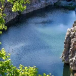
| Character | a deep rock canyon running for several kilometers |
| Film location | used in the movie “Dovbush” |
| Route difficulty | easy–moderate (walking through the water is an option) |
The Geology of the Place
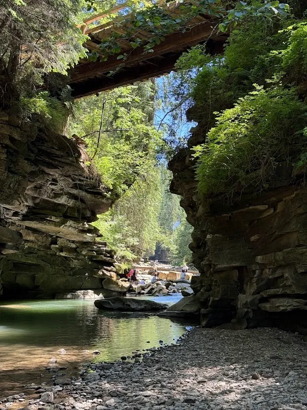
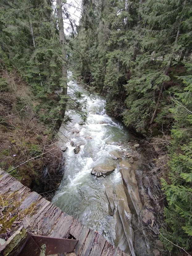
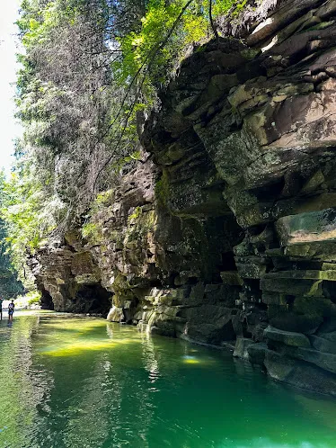
The Prutets-Chemehivskyi is a small but persistent river. Over millions of years it has cut through the rock, forming a deep corridor. Walking along the canyon, you can see striking geological exposures — layers of rock from different geological eras, uncovered by the water along the gorge walls.
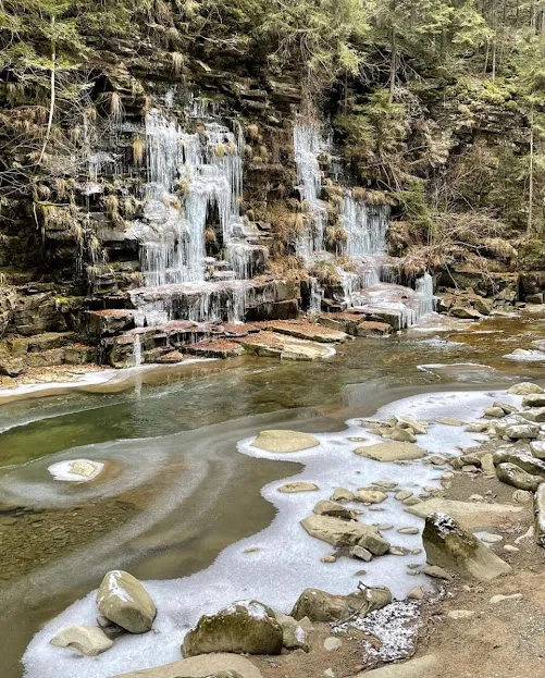
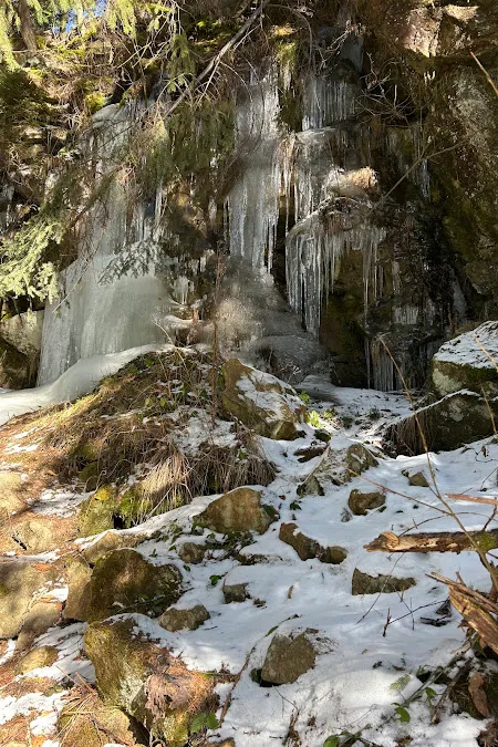
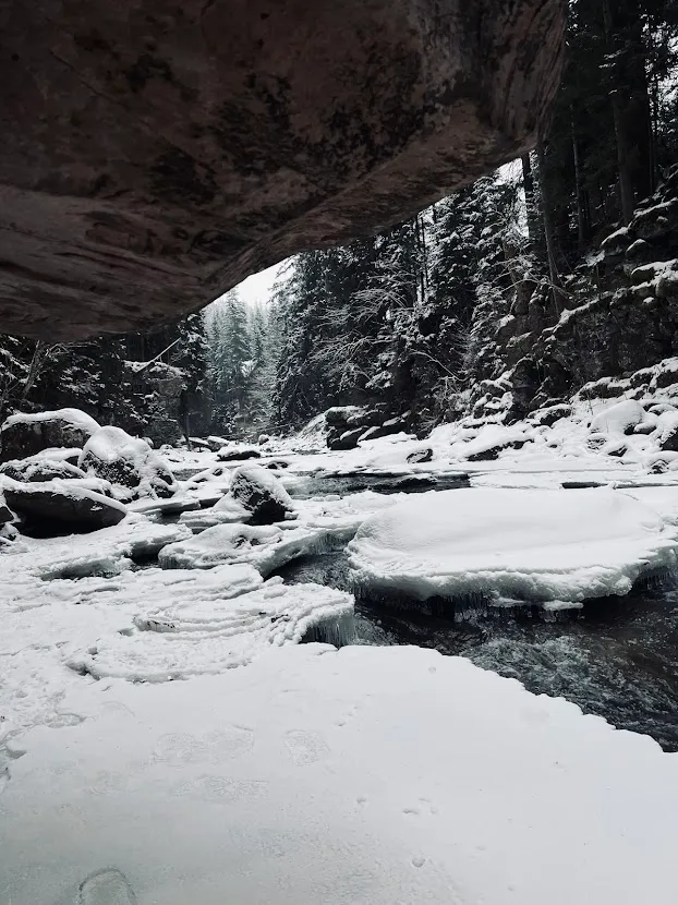
In places, the water has carved several feet (a few meters) into the rock. Small streams trickle down the walls, leaving characteristic wet streaks and carpets of moss. In winter this water freezes, and the canyon takes on an icy appearance.
Atmosphere: the “Carpathian Amazon”
Tourists and bloggers who discovered this place in recent years call it the “Carpathian tropics” or the “Carpathian Amazon,” for the dense vegetation that seems to grow straight out of the rock walls, and for the sense of total wildness.
You don’t look at the landscape here. You’re inside it:
- water rushing right beside you
- your feet sliding on the polished stone
- cold radiating off the rock
- moisture in the air
- light breaking through in narrow strips between the trees
You can walk right along the riverbed (wear a wading suit or roll up your pants) — the best way to experience the canyon from within.
Where “Dovbush” Was Filmed
The film “Dovbush” (2023), one of the most ambitious Ukrainian film projects, was partly shot here. The choice wasn’t accidental: the canyon offers exactly what a film about Carpathian outlaws (opryshky) needs — wildness, impassable terrain, a feeling of another era.
Since the film’s release, Chemehiv Canyon has noticeably grown in popularity.
Route and Landmarks
Start at the center of Mykulychyn, at the bridge over the river. The starting landmark is the Museum of Hutsul Traditional Symbolism.
Follow Kosmonavtiv Street along the Prutets-Chemehivskyi River. Along the way you’ll see the green markers of the “Mykulychyn village – Mount Rokyta” route.
Walk to the sign for the “Hutsul Swing” (also known as the Carpathian swing, a well-known landmark). From there it’s another ~0.6 miles (~1 km) to the canyon.
A convenient way down is from the wooden footbridge (cross it, turn right, go 330 ft / 100 m) — or earlier, near the cross on the trail.
After the canyon, it’s worth continuing on to Barvyshche Waterfall and the Blakytna Lahuna (“Blue Lagoon”) — a low but scenic waterfall and a natural pool near the “Skelia” hotel.
The “Shuhaiv Kamin” rocks (~3,530 ft / 1,076 m) sit higher up the slope, with large grottoes and a panorama of the Carpathians. A stone path leads there from the cliffside waterfall (locally called Sokolovyi).
How to Fit It Into a Route
Chemehiv Canyon makes an ideal add-on to bigger stops in the Yaremche area:
- The Carpathian Swing (~0.6 miles / ~1 km) — for a child-friendly or photogenic attraction
- Probii Waterfall (Yaremche) — ~9 miles (~15 km)
- Mount Hoverla or Petros — for a more demanding route the same day
- Synevyr (~50 miles / ~80 km, over the pass)
Practical Information
- Admission: free
- Address: Kosmonavtiv St., Mykulychyn village (between the “Karpatska Villa” and the “Skelia” hotel)
- Footwear: hiking shoes; if you plan to walk through the water, bring a wading suit or rubber boots
- Time needed: 1.5–2 hours (canyon) plus another hour if you add Barvyshche Waterfall
- Safety: the rocks are slippery, especially in wet weather; water levels rise after heavy rain
- Signal: unstable — download a map offline
How to Get to Mykulychyn
- From Yaremche: ~9 miles (~15 km), along the road following the Prut
- From Ivano-Frankivsk: ~50 miles (~80 km) via the highway through Yaremche
- From Lviv: ~112 miles (~180 km) on the E105 highway via Stryi and Solotvyn, or via Nadvirna
- Parking in Mykulychyn is available near the center and along Kosmonavtiv St.
Little-Known Details
- The name “Prutets-Chemehivskyi” belongs to a small separate river, 13 miles (21 km) long, with a gradient of about 115 ft per mile (35 m per km) — typically mountainous: fast current, a rocky bed, low water in summer and turbulent in spring.
- A nearby cliffside waterfall (unofficially called Sokolovyi) is the only waterfall in the region where two streams merge. It isn’t marked on Google Maps.
- The “Carpathian Amazon” nickname comes from the thorny “vines” and dense vegetation that grow directly out of the rock.
- In winter, the water on the walls freezes, giving the canyon an entirely different look.
- The place became popular thanks to bloggers relatively recently — before that, it was strictly a local landmark.
Conclusion
Chemehiv Canyon isn’t about the “view from the summit” effect. It’s about the feeling of standing between rock and water, almost at the level of the current.
It’s easy to miss on a Carpathian itinerary. But it’s exactly these places — unimpressive from the outside, strange and alive from within — that leave the sharpest memory.