The Kirovohrad region is usually associated with fields, sunflowers, and a flat horizon line.
Which is exactly why what appears near Pantaivka looks unreal.
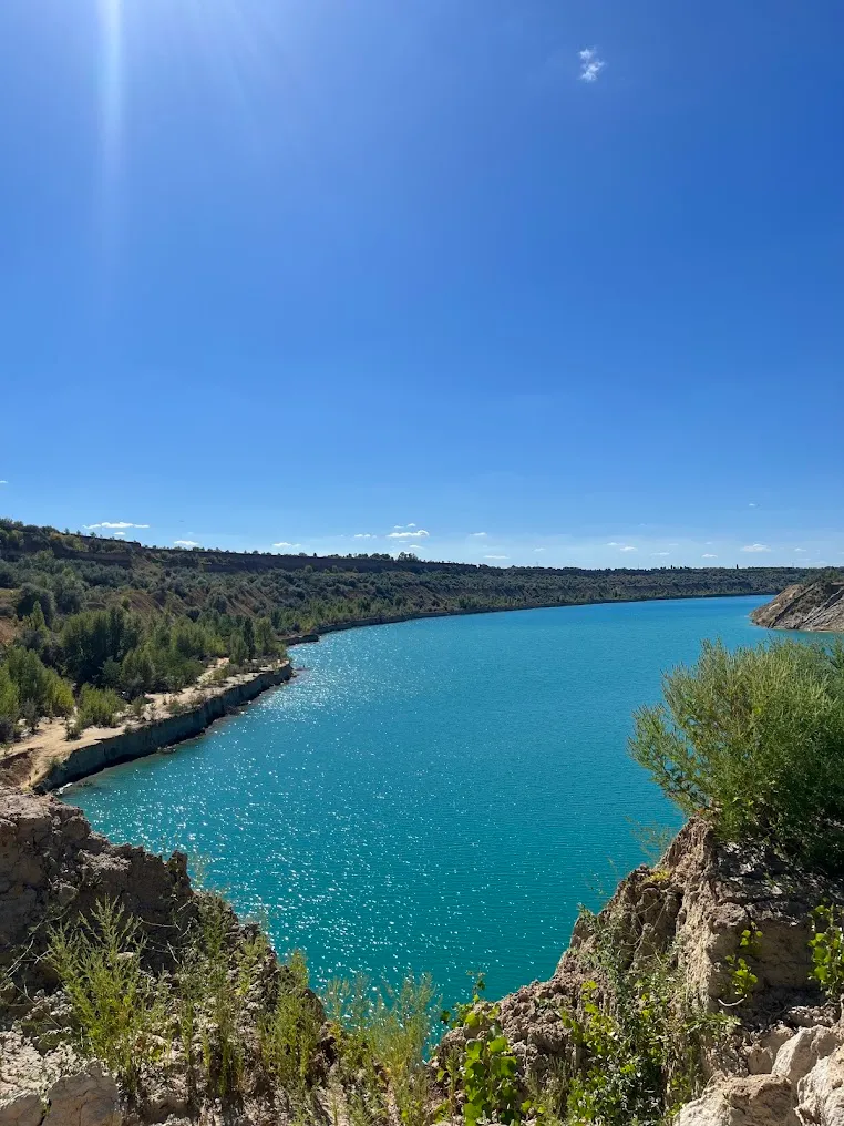
Not a ravine. Not a gully. A 3.7-mile (6 km) wound in the earth shaped like the letter L, with turquoise water at the bottom and the remains of gigantic machinery slowly sinking into it.
General Information
| What? | Description |
|---|---|
| Name | Morozivka Coal Cut |
| Location | between the villages of Pantaivka, Morozivka, and Novoselivka, Oleksandriia district, Kirovohrad Oblast |
| Shape | an “L,” ~3.7 miles (~6 km) long |
| Depth | over 66 ft (20 m), and rising as flooding continues |
| Years of operation | 1970–2004 (some sources say up to 2009) |
| Operator | “Oleksandriiavuhillia” (part of the Dnipro Lignite Basin) |
| Status | abandoned; gradually flooding with groundwater |
| Tourist ranking | one of Ukraine’s Top 7 “stalker” sites (per Insider) |
What It Is and How It Formed
Central Ukraine, in the Oleksandriia district of the Kirovohrad region, holds deposits of lignite (brown coal). It’s mined by the open-pit method: topsoil is stripped away and the pit is dug ever deeper. Several such cuts once operated here; Morozivka is the largest and best known.
From 1970, massive machinery worked this site. In 1976, the cut became part of “Oleksandriiavuhillia,” the largest enterprise in the Dnipro Lignite Basin.
By the early 2000s, the operation had become unprofitable. The pit was closed, and the machinery was left exactly where it stood.
Groundwater began filling the pit. Today its depth already exceeds 66 ft (20 m), and the water keeps rising.
Three Things That Make This Place Unique
1. A 984-ft (300 m) bridge — the only one of its kind in Ukraine.
The two sides of the pit are connected by a 984-ft (300 m) transport-and-spoil bridge — there’s nothing else like it anywhere in the country. The bridge was manufactured in Germany before World War II, and part of it still stands.
2. A graveyard of excavators.
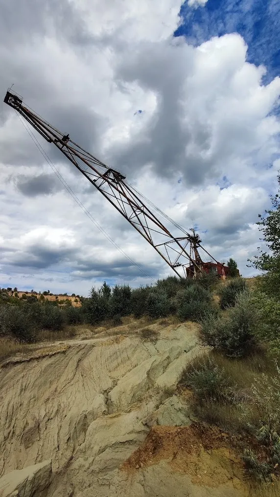
Gigantic abandoned machinery remains on site. One excavator, a rotary walking-rail type, weighs almost 4,000 metric tons. Two smaller ones, also of pre-war German manufacture, sit nearby. Most of it is already underwater; some has been dismantled by scrap-metal scavengers. What remains visible above the surface forms an eerie silhouette.
3. Turquoise water.
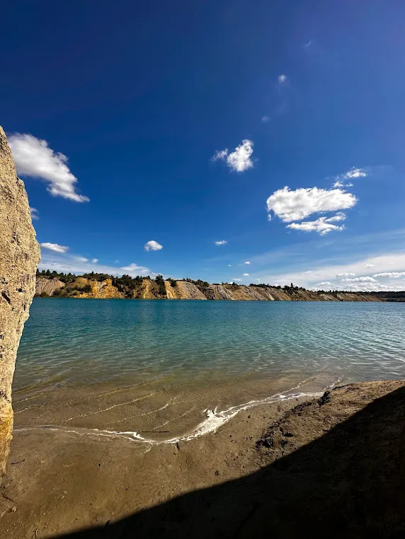
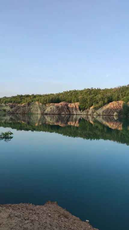
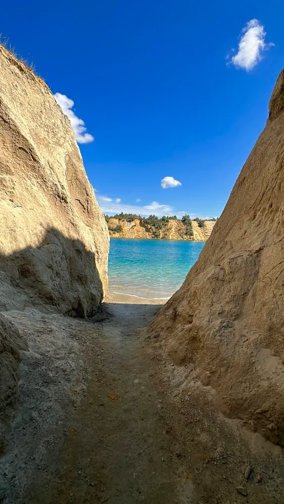
The water in the pit is turquoise and crystal clear. The color comes from the great depth and the absence of silt — the same effect seen in mountain lakes, only here it appears in the middle of the steppe.
A Vanished Settlement
Next to the pit once stood the village of Morozivka, most of whose residents worked at the mine. When the operation shut down, people left in search of work. Today, Morozivka has effectively disappeared.
This adds another dimension to the site: not just an abandoned pit, but an entire way of life that stopped all at once.
Scale and Geometry
The pit’s shape resembles the letter “L.” Its length is 3.7 miles (6 km). Its depth exceeds 66 ft (20 m).
From above, or by drone, this geometry is striking: straight lines of terraces, spoil heaps, and service roads within the pit — all of it human architecture, built not for people but for machines.
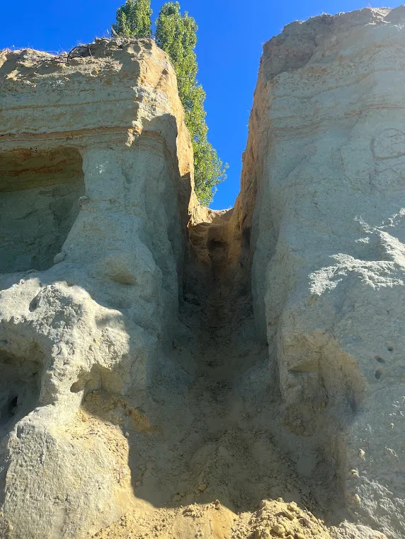
From the edge, you can see multi-level terraces, layers of clay and sand in different colors, and yellow-red cross-sections. Below: water.
⚠️ Safety
This isn’t a developed tourist site:
- possible landslides on unstable slopes
- loose, crumbling edges
- deep pits filled with water, without warning
- submerged machinery is a hidden hazard for anyone swimming
- no perimeter fencing (the site is simply too large)
- no phone signal at the bottom
Approaching the edges closely is dangerous. Descending should only be attempted with experience, and in company.
How to Fit It Into a Route
Morozivka isn’t the only cut of its kind in the district. Nearby is the Kostiantynivka Coal Cut (also a “graveyard of excavators,” though less flooded — currently about 10 ft / 3 m deep). Together they form a unique industrial route through the Oleksandriia area.
From Kropyvnytskyi, cycling routes run through Adzhamka or Subotsi (about 31 miles / 50 km).
Fits into the “Industrial Landscapes of Ukraine” route.
Practical Information
- Admission: free (guards are present, but the perimeter isn’t fenced)
- Landmark: Pantaivka village — 1.2–1.9 miles (2–3 km) from there to the edge of the pit
- Transport: buses and trains run from Kropyvnytskyi to Pantaivka
- By car: the E50 highway between Oleksandriia and Kropyvnytskyi; turn toward Pantaivka
- By bike: a popular option; ready-made routes exist from Kropyvnytskyi cycling clubs
- Time needed: 30–90 minutes
- After rain: don’t go — the slopes and roads become dangerous
Little-Known Details
- The 984-ft (300 m) transport-and-spoil bridge is the only one of its kind in Ukraine, manufactured in pre-World War II Germany.
- The rotary excavator, weighing ~4,000 metric tons, is one of the largest machines ever to have operated in the Kirovohrad region.
- Two of the excavators and the bridge are of pre-war German manufacture — they’ve been here since the occupation era.
- Morozivka has effectively disappeared — it wasn’t just the mine that closed, but an entire settlement.
- The cut made the Top 7 “stalker” sites of Ukraine, according to Insider.
- The pit has no perimeter fence, simply because of its size. Guards are present, but everyone enters freely.
Conclusion
The Morozivka cut is a place that’s good for thinking.
Because you can literally see how many meters of earth can disappear for the sake of energy — and how quickly nature starts reclaiming it.
3.7 miles. An “L” shape. Turquoise water above 4,000-ton excavators.
And a vanished settlement nearby.
Sometimes landscapes like this stay with you longer than any “pretty spot.”