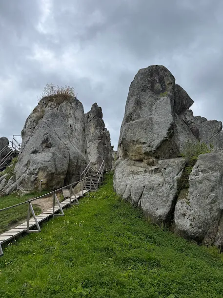
Somewhere between Drohobych and Skole, among the forested slopes of the Skole Beskids, columns of sandstone suddenly rise from the ground. Up to 285 ft (87 m) tall. With holes and grooves cut into the rock — even, geometric, unmistakably made by human hands.
This is Tustan. A medieval fortress of which almost nothing physically remains — but whose traces have never disappeared.
General Information
| What? | Description |
|---|---|
| Official name | Tustan State Historical-Cultural Reserve |
| Location | Urych village, Stryi district (after the 2020 reform; formerly Skole district), Lviv Oblast |
| Type | rock-built wood-and-stone fortress, customs post, fortress-town |
| Period of use | 9th–16th centuries |
| Height of the main rock | 285 ft (87 m) above the valley floor (the Kamin rock group) |
| Area of the central section | ~7 acres (~3 ha) |
| Status | natural, archaeological, and architectural monument of national significance; a state reserve |
Why It’s Unique
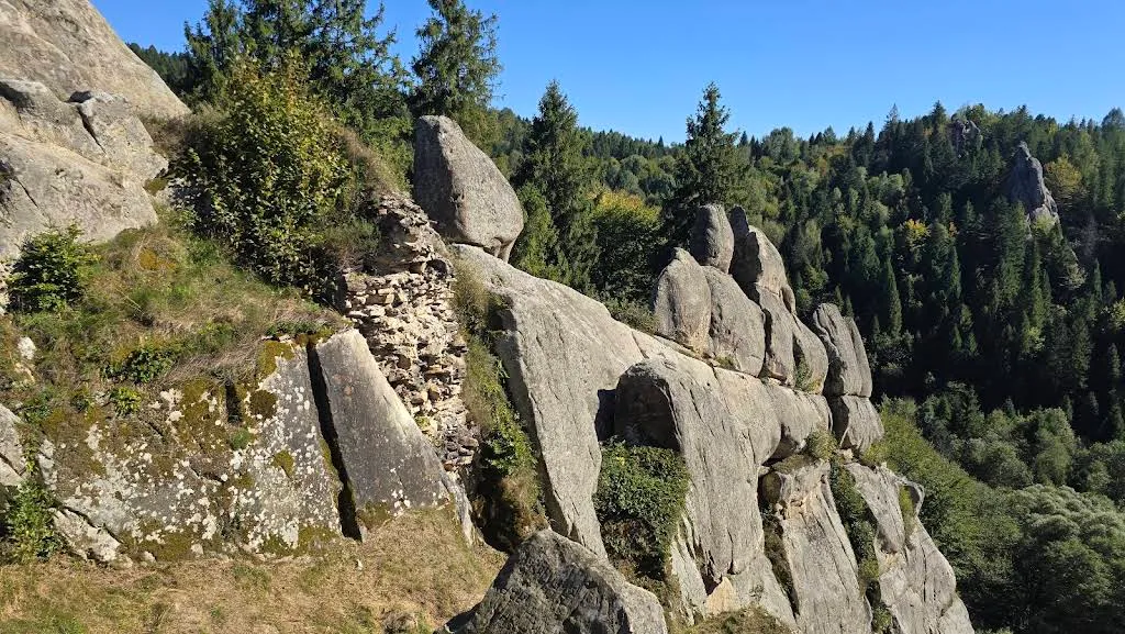
Tustan is the only medieval rock-built fortress of its kind in Ukraine, and one of very few in Europe. Its builders didn’t reshape the landscape — they built the fortress into the rock itself. The stone sandstone columns served as walls in themselves: wooden structures were erected between them, anchored in notches, cuts, and grooves carved directly into the rock.
The wood is long gone. But about 4,000 grooves and openings remain in the stone — and these alone allow the fortress to be reconstructed with 90% accuracy. This work was done by researcher Mykhailo Rozhko, who studied Tustan from 1971 for more than twenty years. The result: a graphic reconstruction of a five-story fortress from the 9th–13th centuries, the first description of this type of rock fortification in Slavic studies.

Geology: Rocks Millions of Years Older Than the Fortress
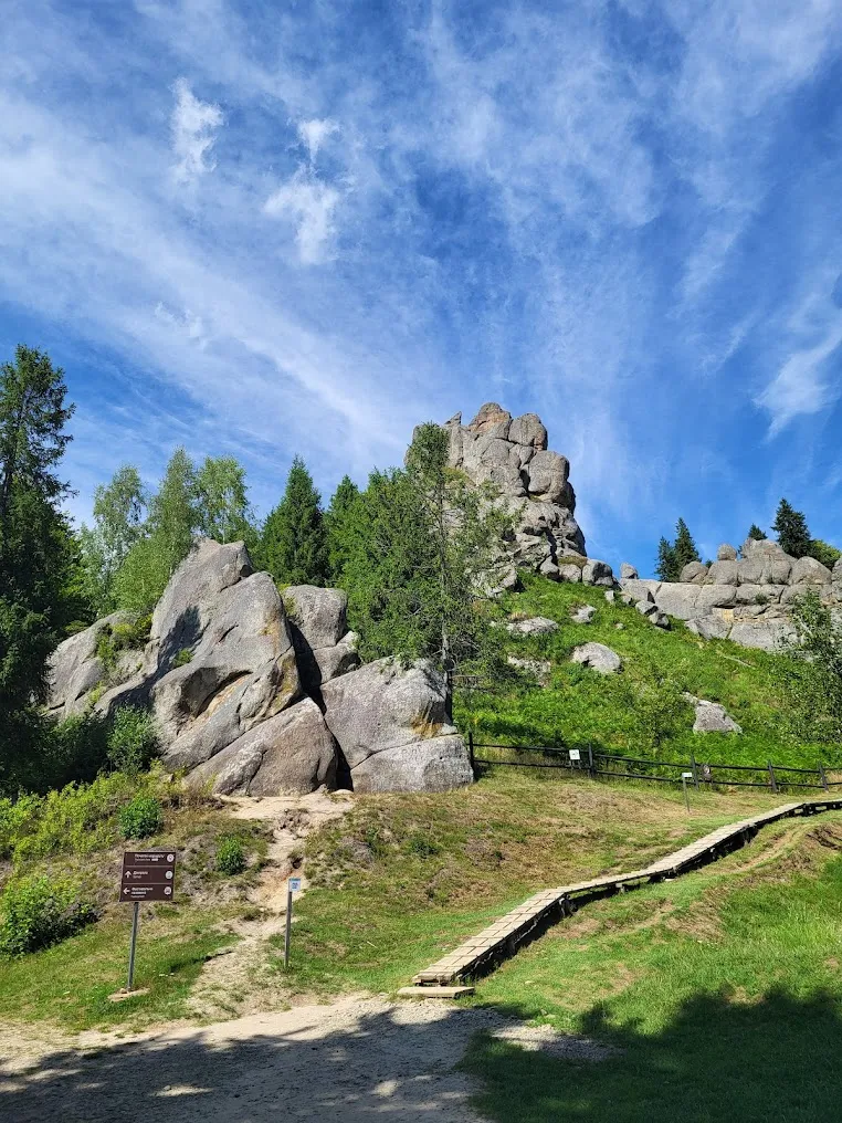
The rock complex at Urych consists of erosion remnants of Yamna sandstone, formed on the floor of the ancient Tethys Ocean roughly 55 million years ago. Mountain-building later lifted these layers to the surface, and weathering carved them into vertical columns, walls, niches, and caves.
There are seven rock groups: Kamin, Hostryi Kamin, Mala Skelia, Zholob (Orel), Gulka, Khrest, and one unnamed. Some have taken on distinctive shapes: “The Four Giants,” “The Three Fingers,” “The Eagle.”
The main dominant feature is the Kamin group, where the fortress stood, rising 87 m (285 ft) above the valley. At its height, the wooden structures rose 131–262 ft (40–80 m) from the valley floor.
From the White Croats to the Polish Crown: a Timeline
9th century. The Slavic tribe of the White Croats settles the rocks and establishes a stronghold here — both a customs post and a defensive outpost. The Salt Road from Drohobych to Zakarpattia and Central Europe ran through Urych: salt was the most valuable commodity before the age of railways. Controlling this road meant controlling a substantial share of regional trade.
11th–13th centuries. Tustan becomes part of the Carpathian defensive line of Kyivan Rus and the Principality of Halych-Volhynia. The fortress grows, is rebuilt after fires, and becomes more complex — researchers identify five construction phases, each changing its size and structure. In the 13th century it reaches its peak, rising to five stories.
1333–1384. The first written mentions appear, in the chronicle of vice-chancellor Jan of Czarnków and later in Jan Długosz: Tustan is listed among the towns and fortresses fortified by the Polish king Casimir III.
1340. Tustan is captured by Casimir the Great, who rebuilds it as a Polish border fortress.
1390. A charter of Pope Boniface IX mentions Tustan as a border fortress and customs point for salt exports from the Drohobych salt works.
16th century. Decline sets in. Central European countries find their own salt deposits, and the Salt Road loses its importance. The Polish border shifts east. In 1539, the fortress passes to a private owner under a deed of gift. 1565 — the last written mention: a survey of the Drohobych salt works records a customs post at Urych. After that, silence.
17th century. Archaeological finds indicate that hermit monks settled on the rocks.
What Archaeologists Found
At the bottom of a water cistern and in the rock crevices: Arab dirhams from the 9th–11th centuries, evidence of international trade links. Also found: arrowheads for bows and crossbows, a bronze mace, an elaborate cross-reliquary, men’s rings, battle axes, and a 9th-century pot.
The rocks themselves bear petroglyphs from different eras — traces left by Dacians, Thracians, Celts, Scythians, and the White Croats. Some are solar signs (circles with a hollow at the center), concentrated on sections that receive sunlight all day. This symbolic system remains only partly deciphered.
What the Fortress Looked Like in the 13th Century
Picture this: between the rock columns, at a height of 40 to 80 meters, five stories of wooden structures. Levels connected by galleries and stairs. Combat walkways running along the rock walls. Inside: barracks, storerooms, a forge, water cisterns. Access from below was blocked by wooden walls and gates anchored into the rock.
Today, all that remains are grooves in the stone, fragments of 13th-century walls, and two rainwater collection cisterns. But thanks to Rozhko’s reconstruction, all of this can be seen in the museum — and mentally overlaid onto the real rocks.
What to See in the Reserve
The reserve is more than just rocks. It’s a whole infrastructure complex:
The Kamin rock group — the main attraction. A marked route from start to finish; there’s no wandering alone, and rightly so — the terrain is difficult.
The Tustan Museum — home to reconstructions, finds, and Rozhko’s graphic materials. Up to 12 visitors at a time.
“The House in Hlyboke” — a cultural center, another point in the reserve. Up to 10 visitors.
A wooden castle structure at the entrance — a small reconstruction, used for festival events.
The “LaZanka” rope park — daily, 10:00 a.m. to 8:00 p.m.
A pottery workshop.
St. Nicholas Church — a wooden church on a hill in Urych village itself.
The “TuStan!” Festival
Every year in early August, the site hosts the “TuStan!” festival of Ukrainian medieval culture — knightly tournaments, workshops, reenactments, and a market. The first event of this kind here took place as far back as 1914, to mark the centennial of Taras Shevchenko’s birth. The festival in its current format has run since 2006.
It’s one of the few events in Ukraine where medieval reenactment happens directly on an authentic site — not in a gymnasium or a parking lot.
What’s Nearby and How to Fit It Into a Route
Tustan pairs naturally with:
- Skhidnytsia (~5 miles / ~8 km) — a mineral-spring health resort, a convenient base
- Skole (~19 miles / ~30 km) — a small mountain town with a railway station
- Truskavets (~19 miles / ~30 km) — for a stay in a larger town
- Dovbush’s Rocks (~25 miles / ~40 km, Bubnyshche) — similar geology and another rock-built site, once part of the same defensive line as Tustan
Practical Information
Admission is paid. Guided tours are available.
Hours:
- April–October: 10:00 a.m.–6:00 p.m.
- November–March: 9:30 a.m.–5:00 p.m.
- Open daily
Contact: tustan.ua
Time needed: at least 2 hours; comfortably, 3–4 hours with the museum and “The House.”
How to Get There
By car: the distance from Lviv is ~68 miles (~110 km) (1.5 hours). Two routes:
- via Truskavets and Skhidnytsia (~110 km);
- via the Kyiv–Chop highway (M06), turning right after Verkhnie Synovydne at the “Urych” sign (~118 km / ~73 miles).
Free parking is available in Urych, by the reserve.
By train plus bus:
- Train Lviv → Skole (~1 hr 25 min – 1 hr 50 min) or Lviv → Stryi;
- From Skole or Stryi — a bus to Urych (check the schedule at tustan.ua);
- Or take a train to Truskavets, then a bus to Skhidnytsia, then walk (~5 miles / 8 km).
Address: Urych village, Stryi district, Lviv Oblast.
Little-Known Details
- The name “Tustan” has a Proto-Slavic origin, likely derived from the name of the site’s founder or first owner — as is the case with many place names of ancient Rus.
- A 9th-century pot found in the rock-cut water cistern is one of the fortress’s oldest artifacts, confirming its early medieval origins.
- Tustan burned down more than once — and was rebuilt each time. Researchers identify five construction phases with changing designs.
- The fortress’s reconstruction, achieved with 90% accuracy, was based not on written sources but purely on analysis of the grooves in the rock — a unique method in Slavic archaeology.
- In 1970, the Soviet feature film “Zakhar Berkut”, based on the novella by Ivan Franko, was filmed here. Residents of Urych took part in the crowd scenes.
- In 2001, the Urych rocks were entered into the state register of immovable archaeological monuments of national significance. Its candidacy for UNESCO listing has been discussed for several decades.
Conclusion
Tustan is a place where nature and people did the work together, and 700 years later, it’s still hard to say where one ends and the other begins.
The rocks here were walls. The grooves in the stone were blueprints. The Salt Road below was the reason for it all.
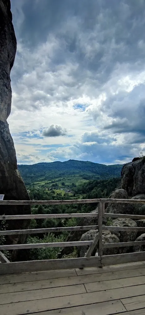
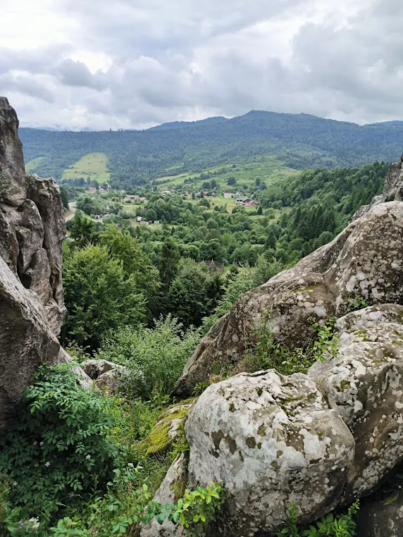
The fortress itself has long been invisible. But it still stands — in 4,000 marks in the sandstone, in Rozhko’s reconstructions, and in the feeling of standing on the rock and looking out at the same mountains the 9th-century guards once did.
Come here not for a “castle” in the usual sense, but for an understanding of what medieval architecture looked like before it separated itself from nature.